


Options
mobile
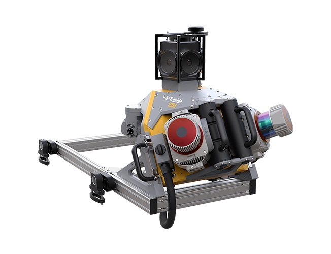
For rail construction or asset management projects, the Trimble® MX9 system is part of a complete field-to-finish mobile mapping solution that combines state-of-the-art hardware with intuitive field software and a reliable office software workflow.
Benefits and performance
Leverage your large-scale rail scanning and mobile mapping projects with the Trimble MX9 system.
Premium, powerful mobile mapping solution
State-of-the-art GNSS and inertial technology combined with leading-edge hardware, with intuitive field software that is easy to install and simple to operate.
Produce and share robust deliverables efficiently
Capture, process, extract and share high density point clouds and rich, immersive imagery to produce meaningful deliverables. Discover new productivity levels leveraging the complete Trimble field-to-finish workflow.
Key specifications
The Trimble MX9 efficiently captures high-precision survey data for rail infrastructure design and corridor mapping.
Quickly obtain geospatial data
Control data acquisition with any smart device and easily adjust the lasers and oblique camera for the best orientation.
Combine LiDAR, GNSS & IMU data
Monitor track conditions and pinpoint irregularities with tightly coupled GNSS and inertial data incorporated into Trimble Business Center software.
High quality deliverables
Create high quality topographic, GIS and CAD deliverables by leveraging the data fusion capabilities of Trimble Business Center software.
Publish & collaborate
Establish a repository of geospatial information to assess changes over time and to share for collaboration.