


Function
inspection
Options
mobile
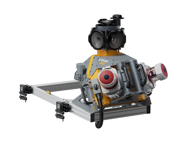
Trusted, field-proven mobile mapping
Capture immersive scans and images at highway speeds.
Benefits and performance
Leverage your large-scale mobile mapping projects with the Trimble MX90, which delivers unmatched GNSS performance in challenging urban and rural environments from the Trimble ProPoint® engine.
Premium, powerful mobile mapping solution
State-of-the-art GNSS and inertial technology, easy to install and simple to operate. With leading-edge image and LiDAR capabilities and intuitive field software.
Produce and share robust deliverables efficiently
Capture, process, extract and share high density point clouds and rich, immersive imagery to produce meaningful deliverables. Discover new productivity levels leveraging the complete Trimble field-to-finish workflow.
Key specifications
The Trimble MX90 captures rich data for modeling and high-density point clouds, ideal for large survey and engineering projects.
Quickly obtain geospatial data
Control data acquisition with any smart device and easily adjust the lasers and oblique camera for the best orientation.
Combine GNSS & inertial data
Trajectory data processing using tightly coupled GNSS and inertial data incorporated into Trimble Business Center software.
High quality deliverables
Create, inspect and analyze high quality survey, engineering CAD and GIS deliverables, by leveraging the data fusion capabilities of Trimble Business Center.
Publish & collaborate
Avoid site revisits by sharing for-collaboration point clouds and images with overlaid existing asset data.