


Function
inspection
Options
mobile
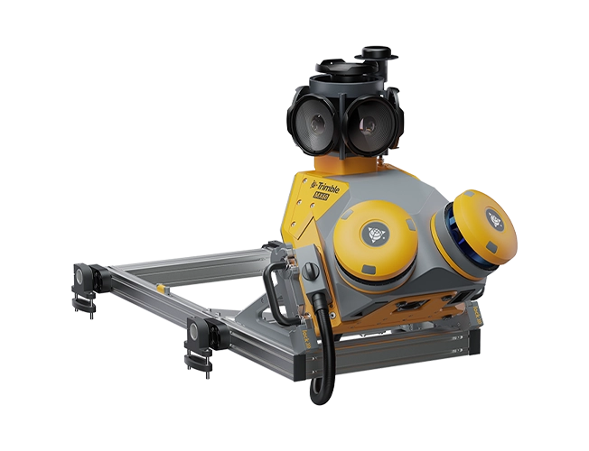
Each project is a journey. Enjoy the ride. The Trimble® MX60 mobile mapping system delivers powerful mobile scanning and imaging for asset management. Take control of your data capture and choose from core, pro or premium models to fit your needs and ensure the perfect solution for every project. Benefits and performance Whether you're just starting your mobile mapping journey, or a seasoned pro looking scale your business, drive your projects forward with the MX60. Effortless end-to-end efficiency The MX60 simplifies data capture and, with purpose-built office software, streamlines field-to-finish asset management and maintenance workflows Driven to deliver Powered by state-of-the-art LiDAR technology, best-in-class GNSS positioning and premium optics, the MX60 delivers comprehensive data for effortless asset management. Key specifications The MX60 brings together the best in laser precision, system accuracy and visual performance at high speeds to ensure top-quality data capture. Quickly obtain asset data High-quality colorized point clouds and 360° immersive imagery with simple, smart device operation and single cable sensor connection. Process vehicle trajectory Trajectory data processing using tightly coupled GNSS and inertial data incorporated into Trimble Business Center (TBC) office software. High-quality deliverables Create surveying, engineering and GIS deliverables using existing data schemas and connect to existing asset databases. Publish, collaborate and store Share point clouds and asset images via the cloud to all stakeholders. Extract asset information and store in the cloud, easily accessible for non-technical users.